


Website demonstrates how coastal habitats may look with higher sea levels
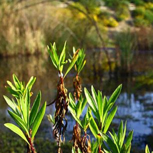
SAN DIEGO, Oct. 17, 2011- San Diego Coastkeeper published today its new website resource demonstrating how the coastline may differ as sea levels rise with global climate change. The website can be found at https://www.sdcoastkeeper.org/learn/san-diegos-waters/sea-level-rise.html. The interactive tool displays possible habitat impacts in the year of 2100 at Tijuana River Estuary, San Diego Bay and Mission Bay for sea level rise of 0.4 meters, 1.5 meters and 2 meters.
To help the region prepare for the changes, Dr. Rick Gersberg from the Graduate School of Public Health at San Diego State University and San Diego Coastkeeper partnered to inform the public of the resource.
“Government officials, coastal planners and local residents need the best available data and information to better prepare our region for potential impacts,” said San Diego Coastkeeper Staff Scientist, Jen Kovecses. “These local data can help reduce some of the associated uncertainty that our decision makers and planners face.”
In making the maps, Dr. Gersberg’s lab gathered coastal data for the San Diego coast and integrated it into an Environmental Protection Agency model called Sea Level Affects Marshes Model (SLAMM). The outcome of that model consists of predicted scenarios showing how ten of San Diego’s coastal habitats might shift as sea levels change. Using different sea level rise scenarios (essentially low, moderate, high sea level rise), the model predicts that San Diego’s coastal habitats may look very different over the next 100 years.
“Our model shows that by 2100, San Diego’s coastline may lose 35 to 43 percent of its ocean beaches, 23 percent of its inland freshwater marshes, 42 percent of its tidal freshwater marshes and 51% of its brackish water marshes,” said Gersberg. “These potential changes and the consequences to habitat alteration are severe and something that we need to take into consideration today as we make planning decisions.”
Coastkeeper worked with Dr. Gersberg to disseminate the results to local government officials, business people, residents and other interested parties. Ultimately, this information formed part of the foundation for a sea level rise adaptation plan for San Diego Bay.
The generous support of the Environment Blasker Grant of the San Diego Foundation made this project possible. The final outcome of Coastkeeper’s partnership with Dr. Gersberg is the interactive map that displays the model results for a subset of coastal areas and key findings from the model analysis. This map will evolve over time as Dr. Gersberg’s lab develops and refines other model results. Consequently, Coastkeeper will update the web page with relevant information.
# # #
Founded in 1995, San Diego Coastkeeper protects the region’s bays, beaches, watersheds and ocean for the people and wildlife that depend on them. We balance community outreach, education, and advocacy to promote stewardship of clean water and a healthy coastal ecosystem. For more information, visit San Diego Coastkeeper online at https://www.sdcoastkeeper.org.