


Watershed Management Plan

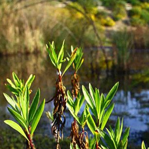
The City of San Diego, University of CA, San Diego/Scripps Institution of Oceanography (UCSD/SIO), and San Diego Coastkeeper make up the La Jolla Shores Coastal Watershed Management Group. Their priority is to manage urban runoff and protect the health of the two adjacent ASBS’s in La Jolla (see picture right).
In 2008 the group authored the Watershed Management Plan that was developed from a series of stakeholder and project partner meetings. Experts from the fields of urban runoff management, ocean and environmental science, data management, and public participation were consulted to develop a holistic program to address the complex issues and California Ocean Plan standards associated with an ASBS.
La Jolla Shores has an ASBS Protection Implementation Program that represents the initial stage of ASBS protection. It supports four essential and interactive components of the Watershed Management Plan, including:
- Urban Runoff Management – addresses needs to reduce watershed pollutant impacts and the prohibition of waste discharges into an ASBS
- Ocean Ecosystem Assessment – addresses the need to identify health of the resources, impact of runoff, and effectiveness of management measures
- Information Systems – addresses the need to develop resource management tool serving variety of end users
- Public Participation – addresses the need to engage public in protection and management of resource
By incorporating all four components, the two La Jolla Shores ASBS will be protected by reducing urban runoff pollutants from discharges and establishes important assessment and monitoring tools. The focus is to reduce or eliminate the primary sources of water quality threats. This plan will provide multiple benefits by protecting not only the ASBS; it also includes high use public beaches and two Marine Protected Areas nearby.
Incorporating Information Management into ASBS Management
Integrated information management systems are a critical tool to efficiently assess and manage regulatory programs. Information management systems can display data in the interrelated language that biological-physical-chemical processes present in the watershed and marine environment. These data can then be assessed and available to a wide range of users that span both regulatory and non-regulatory based data collection efforts.
Our goal was to design a modular problem driven application that builds upon different standards and protocols.
We strived to emulate existing ocean observing systems web portals for ease of navigation and familiarity. Utilizing open standard formats and protocols enables access to varying structures and distributed data sources. Since some of the data shown on the website is derived from other sources, the goal has been to access services or data directly instead of hosting copies. This format allows for varying data types enabling a customized portal.
The online tool that is entering its’ beta testing mode now, was designed to establish the infrastructure needs and generate a conceptual design that is required for long term assessment of ASBS performance and related management decisions. The system will expand upon the current information management framework developed by UCSD/SIO for the La Jolla Shores Coastal Watershed Management Plan. Local and regional information sharing initiatives are promoted, and support low impact development (LID), water conservation, and public engagement through outreach and data visualization. The end-product will be to develop a usable information system for a range of users.
Online Features

The greatest attribute of this site is it allows for various data layers to be viewed together spatially via a central map. While providing metadata, specific data values and time series.
- Large map with slide-able side panels
- Adjustable map-time
- Time series of selected data
- Specific layers have options which can be changed once selected
- Collapsible legends
- Metadata for each layer and links to special studies and documents
- Map bookmarks to help you zoom to areas of interest
Data Layers
The data layers that are included in online tool are grouped by near-real time observations, static point observations, and spatial observations/models.
- San Diego ASBS Meteorological Sensors – Meteorological stations along the coast provide wind speed, wind direction, air temperature, relative humidity, barometric pressure, solar radiation, rainfall, and water temperature data.
- San Diego ASBS Outfall Monitoring Stations – Seawater and storm water outfalls at Scripps Institution of Oceanography that are monitored in accordance with the California Ocean Plan.
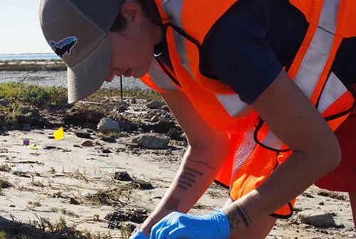
- San Diego ASBS Bacteria Monitoring Stations – Bacteria monitoring in the surf zone is performed weekly in the San Diego-Scripps Area of Special Biological Significance (ASBS). Data shown are the last reported results sent to the State Water Resources Control Board (SWRCB).
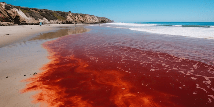
- Harmful Algae & Red Tide Regional Monitoring Program – Water samples and net tows are collected once per week to monitor for HAB (Harmful Algal Blooms) species, and naturally occurring algal toxins, as well as water temperature, salinity, and nutrients. Occurs at 8 piers along the California coastline.
- State of California ASBS System Boundaries – boundaries of the 34 designated coastal regions in the California Ocean Plan as Areas of Special Biological Significance (ASBS) in an effort to preserve these unique and sensitive marine ecosystems for future generations.
- Historic Probability Exposure Maps (2008-2009) – estimated spatial extent of the surface plume for a historical dataset from 2008-2009, to determine the probabilities of exposure of each ASBS to coastal discharges for annual circulation patterns.
- High Frequency Radar Surface Currents – Data collected from high-frequency (HF) radar can be used to infer the speed and direction of ocean surface currents (to 1 meters depth).
- Regional Ocean Model System (ROMS) Model Output – a model produced and distributed by Joint Institute for Regional Earth System Science and Engineering (JIFRESSE) at UCLA and the west coast office of Remote Sensing Solutions, Inc.
- Sea Surface Temperature – analysis map layer displays the NOAA/ NWS/National Centers for Environmental Prediction’s (NCEP) daily, high-resolution, global sea surface temperature analysis.
- Winds – The North American Mesoscale Model (NAM), refers to a numerical weather prediction model run by National Centers for Environmental Prediction (NCEP) for short-term weather forecasting.
- Wave Height – Wave Watch III (WW3) is a third generation wave model developed at NOAA/NWS/NCEP (National Centers for Environmental Prediction).
For more information regarding this online tool or the technical back-end specifics contact [email protected]