


Hopefully you all have seen our new and improved beach status webpage and smartphone app. If not, check it out at our Beach Status webpage. It has never been easier to check for beach closures and advisories.
So, how does it work?

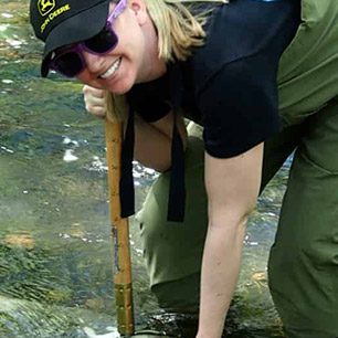
The San Diego County Department of Environmental health is in charge of issuing beach closures and advisories. Every morning, the county sends a team of samplers to take water samples from our beaches. Each beach is tested once a week. They are looking for the quantity of fecal indicator bacteria (Nerd Alert – They are specifically looking at E. coli and enterococci species). These species of bacteria do not necessarily pose a direct human health risk. They are, however, strongly correlated with human health risk. So while enterococcus may not get you sick, high level
s of enterococcus usually means there are elevated levels of pathogens like viruses and the type of bacteria that give you, um, “intestinal distress”. So why not measure viruses and other microbes that actually make you sick? Well, the indicator bacteria are easier, faster and much less expensive to measure. With the same dollars, the county is able to cover more area and have results quickly posted. (Fun Fact! – the county uses the same exact tests to measure beach water as our volunteers use to measure inland water as part of our water monitoring program).
How does this information make it to our website?
Every morning, the county looks at all the beach water quality data and decides whether or not the beach meets EPA guidelines for safe swimming. They also take into account other factors that would make ocean water unsafe for swimming.
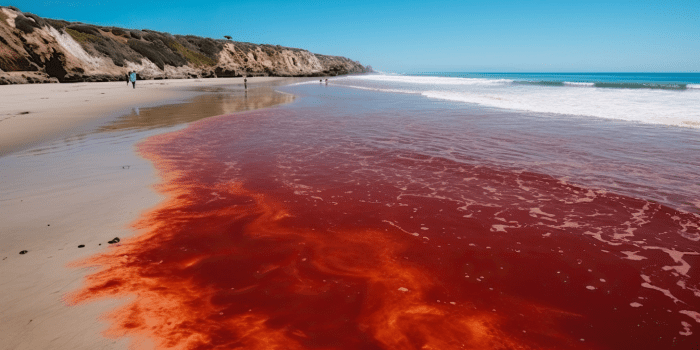
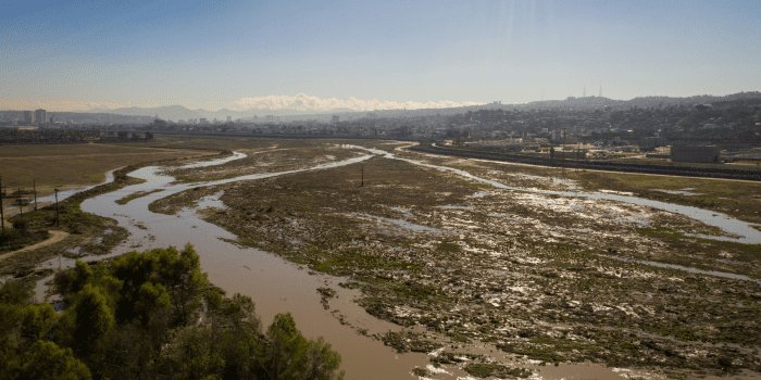
This is a good time to talk about the levels of beach warnings the county issues. The county has three different levels of warnings. We all know what open means, the beach is safe for swimming. They can also issue a contact advisory, meaning water contact should be avoided. They use this level of warning when the bacteria sampling comes up high or a rain event has washed down urban runoff pollutants into the water. They usually don’t put up a sign for contact advisories, so without checking our swim guide, a swimmer usually doesn’t know about these ones. They also issue straight closures. These are issues after a known sewage spill or when the Tijuana River is running into Imperial Beach. In this case they will close the beach off, hang signs saying it’s dangerous to swim, and have lifeguards kick people out of the water. In order to open the beach back up, the county has to have several days worth of testing that shows indicator bacteria within safe health standards. For example, if it rains more than 0.2 inches, they know that all our beaches are going to be impacted by urban runoff and probably unsafe for swimming so they will issue a contact advisory.
How does the Swim Guide fit in?

The county does all of the testing and issuing of closures, but they don’t really have the resources to get the word out.There is a number you can call and listen to a recording, but honestly maps are way cooler. So several years ago, we at San Diego Coastkeeper partnered with the County Department of Environmental Health to help them spread the word. Every morning they send me an email with which beaches are open and which are closed. I translate that to a handy, easy to read, map so that information is more accessible to you, the beach user. San Diego Coastkeeper does not decide which beaches are open or closed. We just pass along information from the county.
The Swim Guide was developed by Lake Ontario Waterkeeper and we thought it was super cool. All of the different coastal waterkeepers in California got together and brought it to our beaches. SO if you get the phone app, it will work for beaches all over the state. Each county has slightly different procedures, but the meaning is the same. Wherever you are in California (or Lake Ontario) the Swim Guide App will be able to make sure you are swimming in safe beaches.
Go to our Beach Status webpage to see current beach conditions and download links for smart phone apps. Pretty soon we’ll have a way of embedding the map in your webpage. So if you are a community group, surf shop, or beachside coffee shop, you can help ensure folks have the most up to the date safe swimming information.